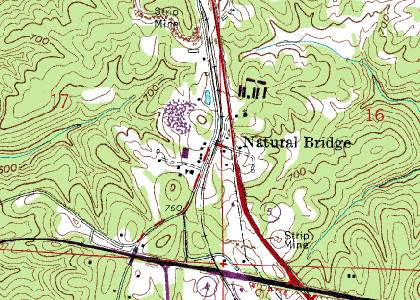
"Hey, ATF. There is an arms cache somewhere on this map. Good luck finding it." -- signed Ramsey A. Bear.
Received this praxis suggestion from a long-time reader:
Dear Mike,First, let me say that I'm praying everything goes well for you in the hospital this week. You've been through a lot these last couple of years.Now on to the praxis. I came across a source for free topo maps that allow you to get the detail you want and of the area you want. I found it on some bushcraft and camping sites. Given the importance of maps to any "insurrectionist", I thought this might be useful. It involves a free program called Gmap4. The linked articles below go into great detail on how to use the program.Here are the links:http://woodtrekker.blogspot.com/2013/07/wilderness-navigation-obtaining-free.htmlhttp://woodtrekker.blogspot.com/2012/05/wilderness-navigation-obtaining-free.htmlhttp://sectionhiker.com/gmap4-great-online-topo-maps-and-map-sharing-for-the-usa-and-canada/Now off to finish reading American Guerrilla in the Philippines . . .

6 comments:
It's almost getting to the point you don't need paper maps any more. Just get a cheap tablet? I haven't tried that but it should work. You should be able to store a lot of maps in one.
I've got a lot of USGS maps stored on an old netbook I bought used. It works fairly well but zooming or moving around on the map really taxes the old Atom CPU; you have to wait a while.
I also put Art Pejsa's ballistic equations into a spreadsheet on that netbook so I have a ballistic calculator.
Pejsa also has sold his own balistic calculator but I thought the user interface was a joke. Perhaps he's improved it by now.
http://home.sprintmail.com/~pejsa/indexballistics.htm
It might be the reverse can also be done; that is, people with ballistic calculators might be able to store maps too.
@Paul X
Hate to point out the obvious, but if there's a large EMP blast in the area, those tablets won't be worth the plastic they're made of. Naturally they're good for now, but paper maps wouldn't be a bad idea.
Obviously paper maps are neccessary for a SHTF situaton, but I came across an Android app called Rmap. Downloadable offline maps of a couple dozen varieties including USGS topos. Precise coordinates, compass integration, seems like a lot of tools. Plan on giving it some testing this fall in the canyon country North of the Grand Canyon. Warning, large file sizes, if you have removable storage then no worries.
Keeping your tablet in a grounded metal container would protect them. Cheapest method: metal trash can, closed lid. Ground it out, store tablet in a static isolating bag for good measure. Less than $20 spent for a decently cheap faraday cage.
I think paper maps make sense if you are operating in one particular area. The tablet idea works better for storing huge numbers of maps. In case you have to go elsewhere you won't be stuck without a map.
Faraday cages don't need to be grounded to work, and in most cases probably shouldn't be grounded so the ground lead does not act like an antenna and make things worse. The external electric field is cancelled by the new electric field generated by the surface rearrangement of electrons; no need for any "drain".
For those thinking of the tablet route, check this out:
http://www.meetearl.com/
Post a Comment